SatSplat: Geometrically-Accurate Gaussian Splatting for Satellite Imagery
The Ohio State University
* Equal contribution † Corresponding author
* Equal contribution † Corresponding author

High-resolution satellite imagery demands 3D reconstruction methods that deliver both speed and geometric accuracy. Recent adaptations of 3D Gaussian Splatting (3DGS) to satellite imagery demonstrate strong efficiency, but reconstruction quality often degrades under diverse illumination across multi-date, high-altitude acquisitions with small intersection angles, limiting applicability to remote sensing and vision tasks.
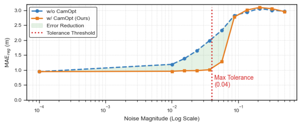
We present SatSplat, the first framework to adapt 2D Gaussian Splatting (2DGS) to satellite photogrammetry, with online camera adjustment. We approximate satellite cameras with an affine model and learn a minimal delta parameterization for in-splat camera refinement from dense observations. To handle time-varying shadows and illumination changes, we integrate geometric shadow mapping and per-camera color correction during training.
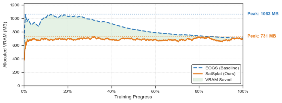
Across the evaluated DFC2019 and IARPA2016 benchmark sites, SatSplat achieves strong geometric accuracy while significantly outperforming prior 3DGS-based baselines. On our processed DFC2019 benchmark, SatSplat reduces mean absolute error by 11.93% and peak video memory by 31% relative to the previous state of the art.
Dataset-level average MAEreg in meters. Lower is better.
| Method | All Classes | Building Only | Time (min) | ||||
|---|---|---|---|---|---|---|---|
| JAX | OMA | IARPA | JAX | OMA | IARPA | ||
| ASP | 2.09 | 1.00 | 2.38 | 1.88 | 2.12 | 1.90 | 2 |
| s2p | 2.98 | 1.30 | 3.28 | 3.45 | 2.13 | 3.20 | 20 |
| SAT-NGP | 3.01 | 2.01 | 2.37 | 3.40 | 3.99 | 2.70 | 23 |
| EOGS | 1.50 | 1.47 | 1.86 | 1.25 | 2.64 | 1.37 | 3 |
| Skyfall-GS (w/o IDU) | 1.78 | 1.22 | 2.55 | 1.45 | 1.69 | 2.17 | 30 |
| Skyfall-GS (w/ IDU) | 1.88 | 1.40 | 2.60 | 1.58 | 1.81 | 2.05 | 120 |
| SatSplat (Ours) | 1.33 | 0.97 | 1.92 | 0.93 | 1.37 | 1.19 | 14 |
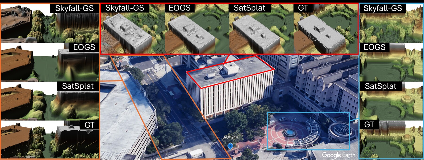
JAX-168, OMA-212, and OMA-315 reconstructions across competing methods.
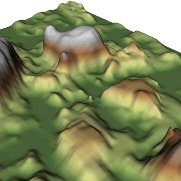
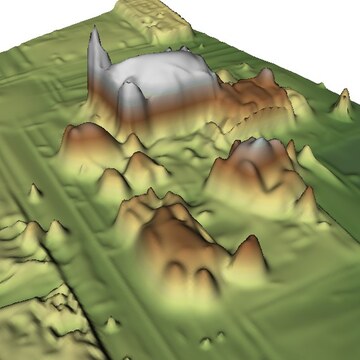
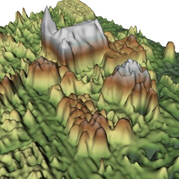
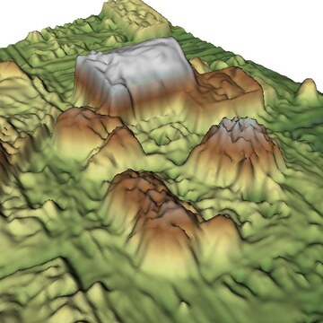
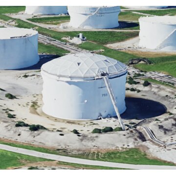
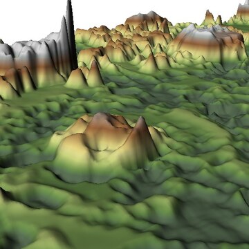
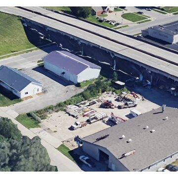
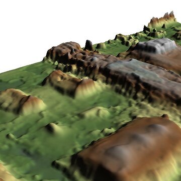
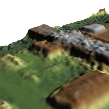
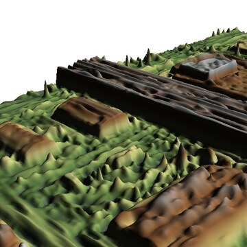
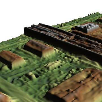
Qualitative comparison on the JAX-168, OMA-212, and OMA-315 sites. SatSplat reconstructs fine-grained details, such as trees and small structures on buildings, while maintaining smooth flat surfaces that are missed or poorly reconstructed by other methods.
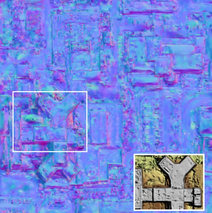
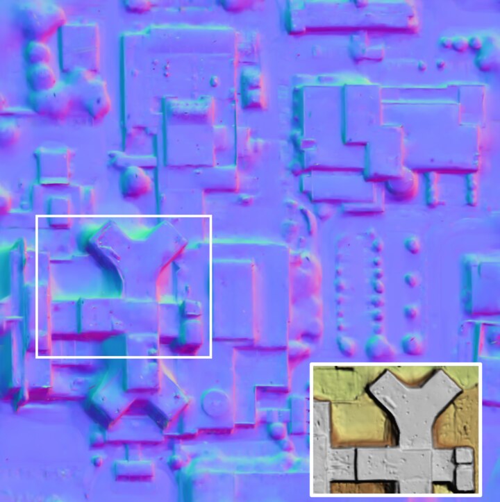
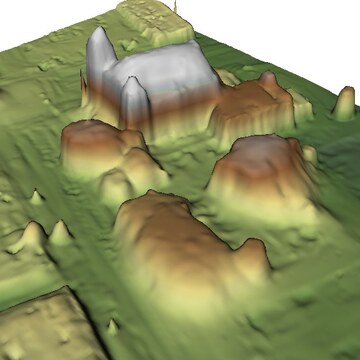
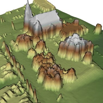
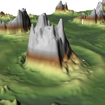
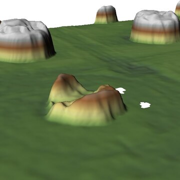
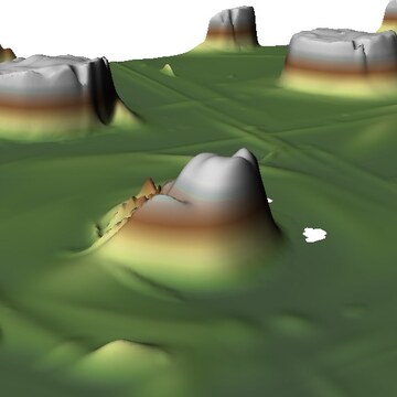
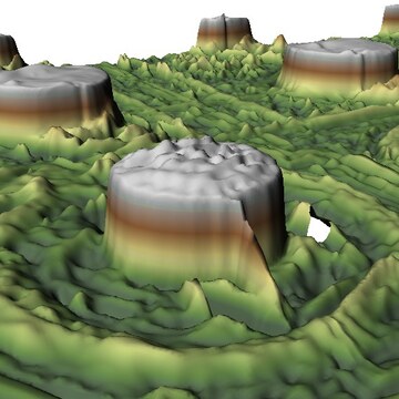
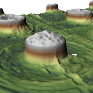
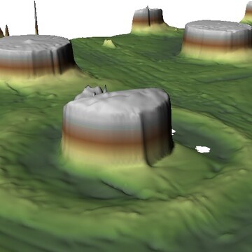
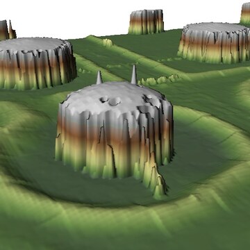
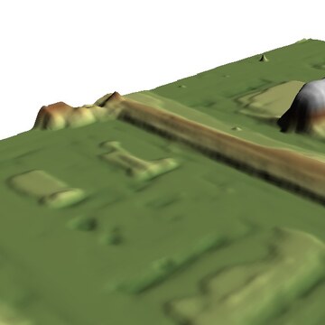
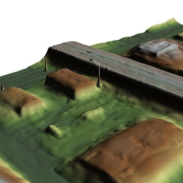
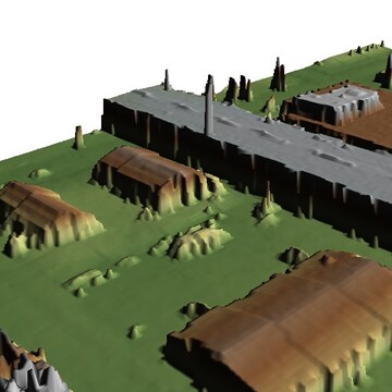
The normal loss leverages the explicit 2DGS surface representation and produces cleaner, more coherent DSM geometry.
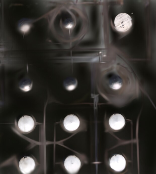
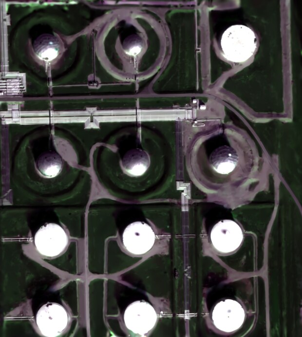
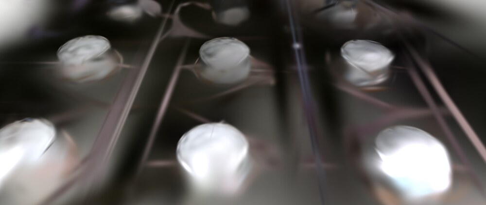
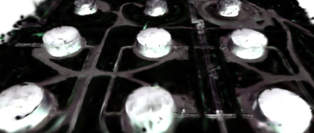
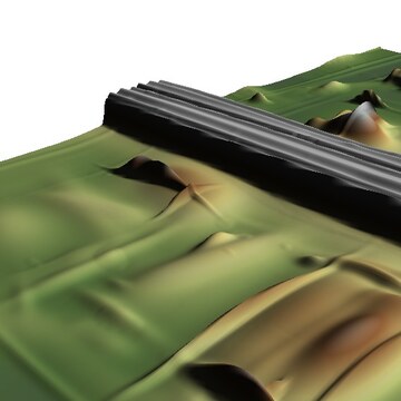
Compared with oversized and floating Gaussians, SatSplat keeps the representation anchored to the terrain surface, improving geometry and rendering quality.
@article{song2026satsplat,
  title   = {SatSplat: Geometrically-Accurate Gaussian Splatting for Satellite Imagery},
  author  = {Song, Shuang and Kim, Jiyong and Qin, Rongjun},
  journal = {Photogrammetric Engineering & Remote Sensing},
  year    = {2026},
  note    = {Coming soon}
}